


The Yolo-Solano AQMD monitors ambient air quality to protect public health and comply with federal and state requirements. Our monitoring network provides real-time data that allows the District to forecast air quality and issues advisories to the public as needed. The monitoring network also allows the District to show progress toward air quality standards.
There are six permanent monitoring sites within Yolo-Solano.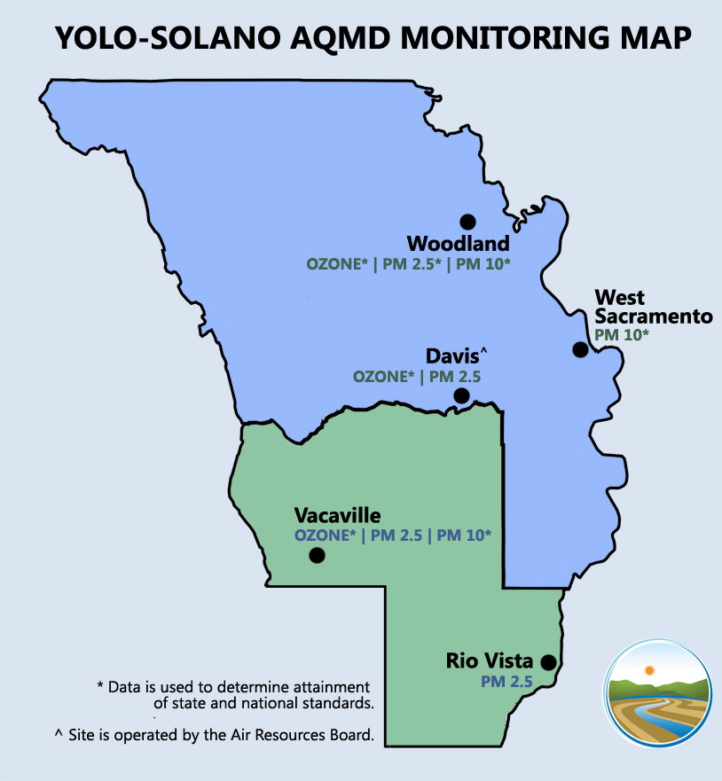
Davis
This site is maintained by the California Air Resources Board (ARB). The site provides real-time data on ozone and PM 2.5 as well as meteorological data.
Rio Vista
This site provides real-time PM 2.5 data.
Vacaville (North)
This site provides filter-based PM 10 data needed for attainment purposes. This site does not provide real-time data.
Vacaville (South)
This site provides real-time ozone and PM 2.5 data as well as limited meteorological data.
West Sacramento
This site provides filter-based PM 10 data needed for attainment purposes. This site does not provide real-time data.
Woodland
This site provides real-time ozone and PM 2.5 data as well as limited meteorological data. In addition, this site provides filter-based PM 2.5 and PM 10 data needed for attainment purposes.
Annual Network Plan
ARB produces an Annual Network Plan that details the state’s air monitoring network. Yolo-Solano AQMD staff works with ARB to accurately reflect the District’s monitoring capabilities and the data collected by the monitoring network for each year. The state Annual Network Plan is submitted to the U.S. Environmental Protection Agency for review.